| |
|
 |
|
 |
|
 |
|
 |
|
 |
|
 |
|
| |
|
Now photographs available
in high resolution for sale.
This site contains surplus
creativity generated in 2010
as a by-product of completing a
print-published photographic
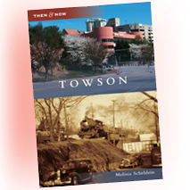
history book. Of my hometown:
Towson, Maryland, USA.
By Melissa Schehlein.
Website by Jason Domasky.
© 2011
|
|
|
| |
|
|
| |
| |
|
|
| |

|
|
|
|
|
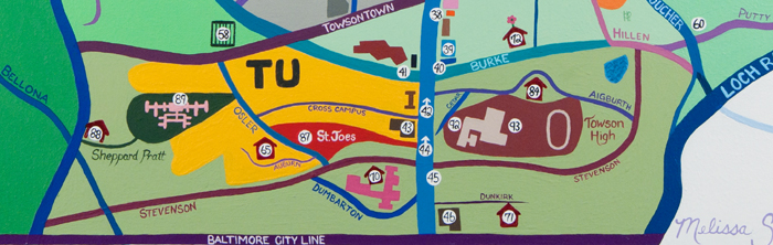
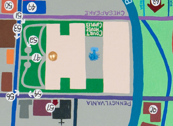
The
Page-Location Funhouse Map is a companion to Towson Then
& Now. A 28x22 acrylic-on-canvas painting in gross
distortion of proportion, showing in graphic detail the location
of every page photographed in the book. If you live or work in
Towson, this should make perfect sense. And perhaps even enhance
your general knowledge of the area, showing where the sites are
along the way. Enjoy the craziness! |
Download
Map in PDF Format |
|
 |
|
Once I decided I needed a map to accompany my book, I had to figure out how best to accomplish it. I started to plot it out on a google-style map, but given that many of my locations were within relatively small spaces on the map, it just didn't work.
Paint it I must.
I ultimately called it a funhouse map, because it so reminded me of those crazy mirrors. It all makes sense, but it's wacky. I definitely stayed within the spirit and truth of the real map, yet the closer you get to the middle, the more myopic it becomes.
This whole art project took approximately 8 weeks to complete, nearly as a full-time endeavor. I expected 4 weeks, at best. I first plotted it out on paper, to get a sense of the distortion that was needed to represent all my locations. Then I transferred that to a 22x28 canvas, and started applying layers of acrylic paint until I was happy with the colors.
I used darker blues and purples for the roads, and for the most part, green represents areas with an abundance of trees and grass, namely, neighborhoods. The gray parts represent the "citified" parts where green space is not readily seen and it is mostly concrete and buildings-not-shown.
|
|
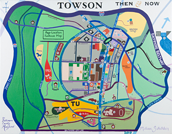
The borders of Towson are Interstate-695 (Baltimore
Beltway), Interstate-83 (Jones Falls Expressway), Loch Raven Boulevard and the Baltimore City line.
|
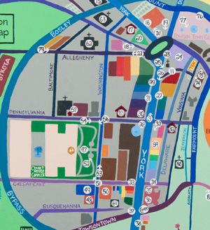
The heart of town. |
|
|
For the buildings that were shown, I tried to stick to the brown/orange/yellow varieties. When possible, I tried to duplicate the color preference of the organizations involved, such as Black & Decker, Towson University, and Towson High.
|
When long-connected buildings occurred, I decided to use rainbow colors. Because I love rainbows. Growing up as a "child of the 70's",
rainbows brought me great joy then and they still do now.
|
 |
|
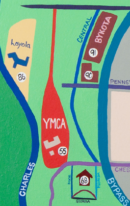
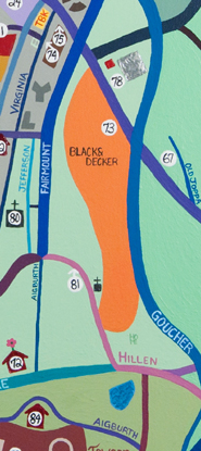
Because of its innate funhouseness, places like the YMCA and the Black & Decker campus took on an odd shape that is not true-to-life; however, its reference to everything else remains intact.
|
|
|
YMCA
|
|
B&D
|
|
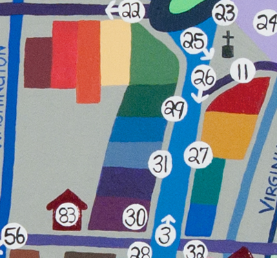
Those black-on-white page dots that emblematize a more sweeping streetscape rather than single location boast directional arrows.
Obviously this is not everything there is to see in Towson. I have only put locations and streets on it that would help you find and see for yourself what was shown in the book.
|
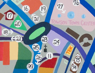
The center of town. Very scenic.
|
|
One last thing. When flipped upside down, with north as south, Towson's courthouses spell out HI.
Just sayin.
|
Welcome to
Towson!
|
|
|
|
|
|
| |
|
|
|
|
| |
|
|
|